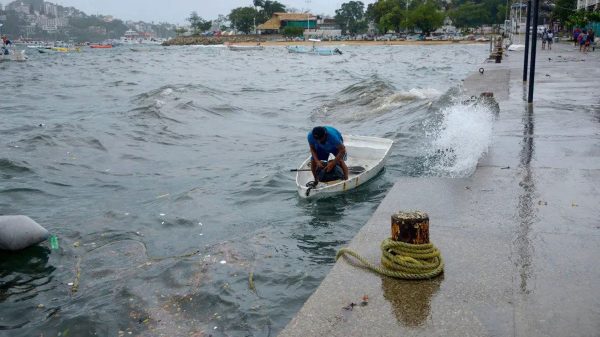
Powerful Hurricane Hilary heads for Mexico’s Baja. Rare tropical storm watch issued for California

- Update Time : Saturday, 19 August, 2023, 01:15 pm
- 130 Time View

Online Desk: Hurricane Hilary churned off Mexico’s Pacific coast Friday as a powerful Category 4 storm threatening to unleash torrential rains on the mudslide-prone border city of Tijuana before heading into Southern California as the first tropical storm there in 84 years. Forecasters warned the storm could cause extreme flooding, mudslides and even tornadoes across the region.
Hilary grew rapidly in strength early Friday before losing some steam, with its maximum sustained winds clocked at 130 mph (215 kph) in the evening, after falling from 145 mph (230 kph). Nevertheless, it was forecast to still be a hurricane when approaching Mexico’s Baja California peninsula on Saturday night and a tropical storm when approaching Southern California on Sunday. Hilary was already disrupting life.
Major League Baseball rescheduled three Sunday games in Southern California, moving them to Saturday as part of split-doubleheaders. The National Park Service closed Joshua Tree National Park and Mojave National Preserve to keep people from becoming stranded amid flooding. Cities across the region, including in Arizona, were offering sandbags to safeguard properties against floodwaters.
No tropical storm has made landfall in Southern California since Sept. 25, 1939, according to the National Weather Service. The watch was posted for a wide swath of Southern California from the coast to interior mountains and deserts. The U.S. National Hurricane Center warned of potential threats to life and property.
The latest forecast pointed to Hilary making landfall along a sparsely populated area of the Baja peninsula Sunday, about 200 miles (330 kilometers) south of the Pacific port city of Ensenada. As it moves north, it could bring heavy rains to Tijuana. Mayor Montserrat Caballero Ramirez said the city was tracking the storm closely and clearing out storm drains.
The sprawling border metropolis of 1.9 million people is particularly at risk of landslides and flooding, in part because of its hilly terrain. Shacks are perched on cliffs with little vegetation to hold soil in place. In addition, dozens of people live under tarps on the streets and in canals in flood zones, including migrants who arrive daily from various parts of the world.
The city was setting up four shelters in high-risk zones and warning residents in risky zones, Caballero Ramirez said. “We are a vulnerable city being on one of the most visited borders in the world and because of our landscape,” she said. Mexico issued a tropical storm watch for parts of mainland Mexico and put 18,000 soldiers on alert.
On Friday evening, Hilary was centered about 310 miles (495 kilometers) south-southwest of Cabo San Lucas, near the southern tip of the Baja peninsula. It was moving northwest at 12 mph (19 kph) and was expected to turn more toward the north. Some Cabo San Lucas schools were being prepared as temporary shelters, said Flora Aguilar, a city official.
In La Paz, the picturesque capital of Baja California Sur state on the Sea of Cortez, police patrolled closed beaches to keep swimmers out of the whipped-up surf. Schools were shut down in five municipalities. It was increasingly likely that Hilary would reach California early Monday while still at tropical storm strength, though widespread rain was expected to begin as early as Saturday, the National Weather Service’s San Diego office said.
Hurricane officials said the storm could bring heavy rainfall to the southwestern United States, dumping 3 to 6 inches (8-15 centimeters) in places, with isolated amounts of up to 10 inches (25 centimeters), in portions of southern California and southern Nevada. “Two to three inches of rainfall in Southern California is unheard of” for this time of year, said Kristen Corbosiero, a University of Albany atmospheric scientist who specializes in Pacific hurricanes. “That’s a whole summer and fall amount of rain coming in probably six to 12 hours.”
The region could face once-in-a-century rains and there is a good chance Nevada will break its all-time rainfall record, said meteorologist Jeff Masters of Yale Climate Connections and a former government in-flight hurricane meteorologist.
President Joe Biden said the Federal Emergency Management Agency had pre-positioned staff and supplies in the region. “I urge everyone, everyone in the path of this storm, to take precautions and listen to the guidance of state and local officials,” Biden told reporters Friday at Camp David, where he is meeting with the leaders of Japan and South Korea.
Deputies with the Los Angeles Sheriff’s Department announced warnings over public address systems and urged homeless people living in riverbeds and other potentially dangerous areas to move into shelters before the storm hits. Authorities in the city were also helping arrange food, cots and shelters for people who needed them, officials said at an afternoon news conference.
Janice Hahn, chair of the Los Angeles County Board of Supervisors, said planning had been underway for several days, which included evacuation plans for the tourist destination of Santa Catalina Island, off the coast. “I don’t think any of us — I know me particularly — never thought I’d be standing here talking about a hurricane or a tropical storm,” Hahn said.
Officials in Southern California were also re-enforcing sand berms, built to protect low-lying coastal communities against winter surf, like in Huntington Beach, which dubs itself as “Surf City USA.” In nearby Newport Beach, Tanner Atkinson waited in a line of vehicles for free sandbags at a city distribution point. “I mean a lot of people here are excited because the waves are gonna get pretty heavy,” Atkinson said. “But I mean, it’s gonna be some rain, so usually there’s some flooding and the landslides and things like that.”
SpaceX delayed the launch of a satellite-carrying rocket from a base on California’s central coast until at least Monday. The company said conditions in the Pacific could make it difficult for a ship to recover the rocket booster.
Storms don’t usually hit Southern California because prevailing winds usually push them either due west into open ocean or northeastward into Mexico and other parts of the U.S. Southwest, according to experts. “Almost all of them just go out to sea. That’s why we never hear about them,” said Kerry Emanuel, a hurricane professor at Massachusetts Institute of Technology.
That’s unlikely to happen with Hilary mostly because of a high pressure heat dome that is expected to bring triple digit heat indices in the Midwest and block the eastern turn, Masters said.


